


Voting District 0400014, Suffolk County, New York
About
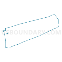
Outline

Summary
| Unique Area Identifier | 637427 |
| Name | Voting District 0400014 |
| County | Suffolk County |
| State | New York |
| Area (square miles) | 0.65 |
| Land Area (square miles) | 0.65 |
| Water Area (square miles) | 0.00 |
| % of Land Area | 100.00 |
| % of Water Area | 0.00 |
| Latitude of the Internal Point | 40.87139350 |
| Longtitude of the Internal Point | -73.37614540 |
Maps


Graphs
Select a template below for downloading or customizing gragh for Voting District 0400014, Suffolk County, New York


Neighbors
Neighoring Voting District (by Name) Neighboring Voting District on the Map
- Voting District 0400043, Suffolk County, NY
- Voting District 0400084, Suffolk County, NY
- Voting District 0400132, Suffolk County, NY
- Voting District 0400141, Suffolk County, NY
- Voting District 0400152, Suffolk County, NY
- Voting District 0400156, Suffolk County, NY
Top 10 Neighboring County Subdivision (by Population) Neighboring County Subdivision on the Map
Top 10 Neighboring Place (by Population) Neighboring Place on the Map
Top 10 Neighboring Unified School District (by Population) Neighboring Unified School District on the Map
- Huntington Union Free School District, NY (34,810)
- Harborfields Central School District, NY (18,722)